

Modern levels have revolutionized geodetic measurements. In 2025, digital instruments achieve an accuracy of ±0.1 mm/km, with prices starting at $50 for basic laser models. Electronic devices with automatic leveling enable 30-50% faster operation compared to optical analogs during large-scale measurements, meeting the requirements of international standard ISO 17123-2 for field verification of geodetic equipment.
Choosing the right tool is like selecting a precise scalpel for microsurgery. Each type addresses specific elevation measurement tasks. It’s worth noting that an incorrect choice can lead to significant project errors and financial losses of up to $5,000 on large sites due to rework.
Expert tip: When selecting a level, always consider the working range and operating conditions. For indoor tasks, a positional laser level is sufficient; for open sites, a rotary level with a receiver is ideal.
Types of Modern Levels and Their Applications
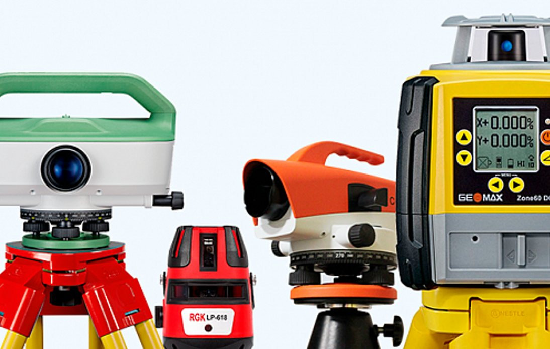 Geodetic instruments are divided into several categories according to the international classification ISO/TC 172. Optical devices remain a reliable choice for basic measurements. In my work with private clients, I often encounter overpayment for unnecessary features—a simple laser level for $200 handles tasks in residential construction better than a professional device costing $5,000.
Digital and Electronic Devices
Digital instruments are equipped with barcode rods for automatic data reading. Their accuracy is just ±0.3 mm/km, per international standard ISO 17123-2. Built-in memory stores up to 10,000 elevation measurements. Professional models from Leica and Trimble cost $3,000-8,000 but pay off through work speed within 6-12 months with regular use.
Electronic devices provide automatic leveling in 3-5 seconds. Mastering all features isn’t always straightforward. However, efficiency increases significantly with regular use, especially with levels featuring pendulum compensators.
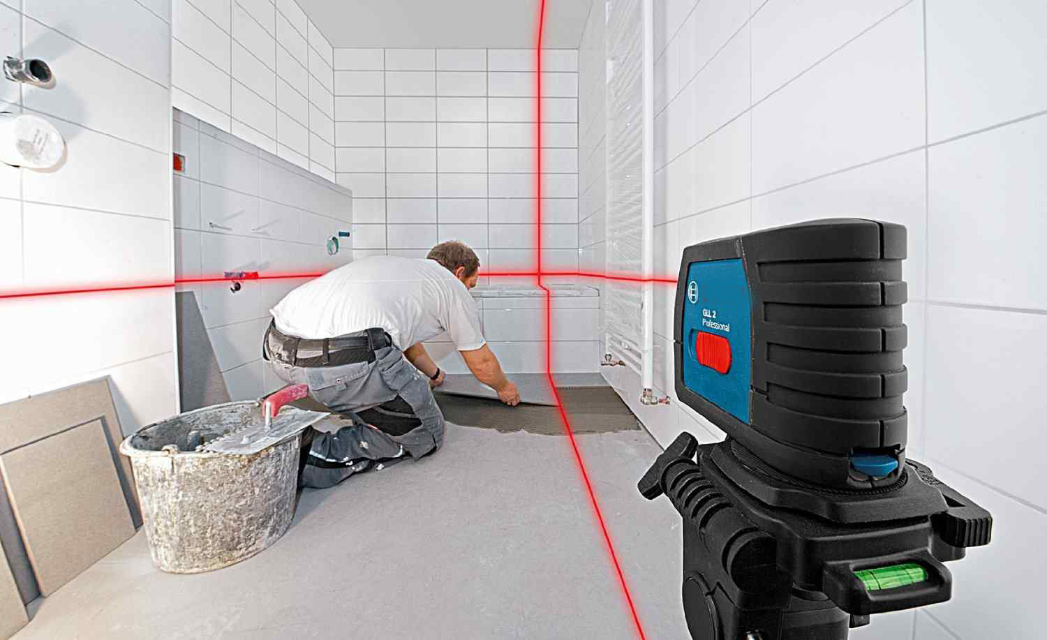
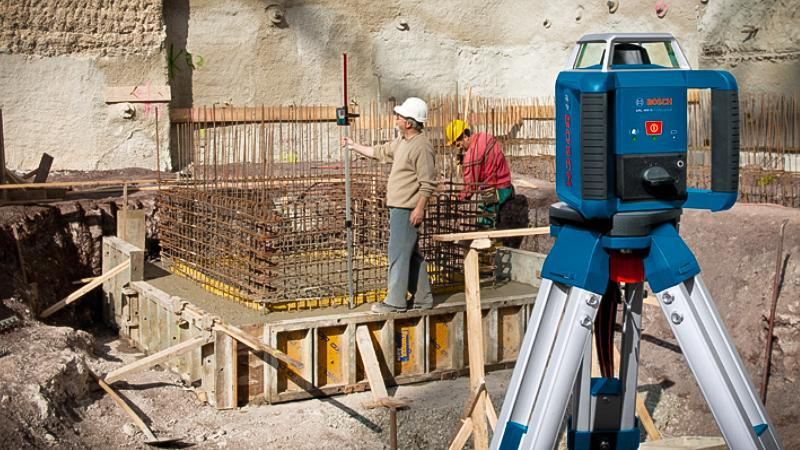
Laser and Rotary Devices
 Laser devices project both horizontal and vertical planes simultaneously. The working range reaches 600 meters with a laser receiver. In one project last season, self-leveling devices compensated for a tilt of up to ±5° on an uneven cottage foundation.
Rotary devices create a 360° laser plane, allowing one operator to replace an entire team of surveyors. Positional devices are suitable for precise indoor tasks requiring high terrain leveling accuracy.
The following table compares the key characteristics of different level types to aid in making an informed purchase decision.
| Level Type | Accuracy | Range | Price (USD) | Setup Time | Application |
|---|---|---|---|---|---|
| Optical | ±2-3 mm/km | 100-150 m | 300-800 | 5-10 min | Topography, construction |
| Digital | ±0.3-1 mm/km | 150-200 m | 3,000-8,000 | 1-2 min | High-precision tasks |
| Laser Positional | ±2-3 mm/10 m | 20-50 m | 50-500 | 3-5 sec | Finishing, marking |
| Rotary | ±0.1-0.3 mm/km | 300-600 m | 800-5,000 | 3-5 sec | Large-scale projects |
The table data reflects the real specifications of devices from leading manufacturers, helping determine the optimal balance of price and functionality for specific tasks.
Success story: "Johnson & Co construction company reduced foundation marking time by 60% after purchasing a Bosch GRL 300 HV rotary level for $1,200. The cottage community project was completed two weeks ahead of schedule, saving $15,000 due to reduced equipment rental time." — Mike Johnson, chief engineer
Accuracy Requirements for Levels at Construction Stages
 Different construction stages require varying levels of geodetic measurement accuracy, per SP 126.13330.2012 "Geodetic Works in Construction":
- Building axis layout: ±5 mm for residential buildings, ±3 mm for industrial
- Foundation leveling: ±5 mm from the design elevation
- Structure installation: ±10 mm in height for standard buildings
- As-built survey: ±2-3 mm for critical structures
Understanding these requirements helps select the appropriate accuracy class for geodetic equipment and avoid overpaying for excessive precision.
Technical Specifications of Modern Devices
.jpg) Specifications determine each device’s application. High-precision instruments ensure elevation measurements with minimal error, per GOST 10528-90 "Levels." Considering design features, devices with compensators automatically correct minor deviations within a ±15 arc-minute range, critical for unstable soils per SP 126.13330.2012.
Specifications determine each device’s application. High-precision instruments ensure elevation measurements with minimal error, per GOST 10528-90 "Levels." Considering design features, devices with compensators automatically correct minor deviations within a ±15 arc-minute range, critical for unstable soils per SP 126.13330.2012.
Accuracy and Measurement Standards for Levels
Accuracy varies widely depending on the device class. Technical models have an error of ±10 mm/km for double-run leveling. High-precision geodetic devices achieve ±0.1 mm/km, meeting international standard ISO 17123-2 requirements. In one project last season, we used a Leica DNA03 with a record accuracy of ±0.3 mm/km to monitor deformations in a historic building.
Automatic leveling performs flawlessly when operating conditions are met. Invar rods (with a thermal expansion coefficient of 1.2×10⁻⁶ K⁻¹ at 20°C) ensure measurement stability across temperature fluctuations from -40°C to +60°C. It’s known that invar’s expansion coefficient is 10-12 times lower than that of regular steel, critical for high-precision geodetic work.
Range and Laser Beam Visibility
The device’s working range depends on the laser type and ambient lighting conditions. A red beam is visible up to 30 meters in daylight, while a green beam extends to 50 meters without a receiver. Professional devices with receivers operate up to 600 meters, covering large construction sites with a single setup.
In practice, I often notice that range is critical for equipment selection. What’s the point of buying an expensive device if its beam doesn’t reach the far wall of a building? It’s better to choose a model with extended range or a receiver.
Practical tip: In sunny weather, use laser glasses for better beam visibility. For distances over 100 meters, always use a receiver for accurate measurements.
Common Mistakes When Choosing a Level
Choosing a level is often accompanied by costly mistakes. Purchasing an unsuitable device can cost thousands of dollars. In a recent cottage project, a client overpaid $2,000 for features they never used.
Main mistakes when buying a level:
- Overpaying for excessive functionality — purchasing a $5,000 digital level for terrace marking
- Ignoring operating conditions — choosing a model without IP54 protection (dust and splash resistance) for outdoor work
- Underestimating accuracy requirements — using a technical level (±10 mm/km) for high-precision geodetic tasks
- Lack of service support — buying exotic brands without official dealers in the region
Practical tip: Before purchasing, determine the maximum working range, required accuracy, and operating conditions. This will help avoid overpaying and select the optimal level for your tasks.
How to Choose a Level for Construction
Level Selection Criteria
The first criterion is the required measurement accuracy. The second is operating conditions and dust/moisture protection. The third is the project budget and equipment investment payback.
Construction levels should have at least IP54 protection (dust and splash resistance). A temperature range of -20°C to +50°C covers most climate zones. Battery life should be at least 20 hours.
Brand Recommendations
Professional levels are produced by Leica, Topcon, Trimble, and Sokkia. For everyday tasks, Bosch, DeWalt, and Stabila are suitable. Terrain leveling requires high-precision devices starting at $3,000.
Expert opinion: "When choosing between brands, pay attention to the availability of service support in your region. A simple repair can take months if there’s no authorized service center nearby."
Quick Checklist: Which Level to Choose
The right level choice depends on specific tasks and working conditions. Use this checklist to make a decision:
✅ By Task Type:
- Indoor finishing up to 50 m → Laser positional ($50-500)
- Foundation and outdoor work → Rotary ($800-5,000)
- Geodesy and topography → Digital/optical ($300-8,000)
- Large construction sites → Rotary with GPS ($2,000-10,000)
✅ By Operating Conditions:
- Normal indoor conditions → Any type
- Dusty/wet conditions → IP54 or higher
- Extreme temperatures → Range of -20°C to +50°C
- Remote sites → Models with extended battery life
✅ By Budget and Payback:
- One-off tasks → Rental or basic models
- Regular use → Professional models
- High-precision projects → Digital levels with minimal error
Visualizing Level Operation
Understanding the operating principles of different level types will help make the right choice for specific tasks.
Laser Projection Types:
Types of Laser Levels: Positional, Linear, Rotary
Leveling Principles:
- Manual leveling — Operator adjusts the device using a bubble level
- Automatic (pendulum) — Built-in compensator (suspended prism system) automatically aligns the beam within ±3-5°
- Electronic — Digital sensors and servo motors ensure precise positioning
Beam Projection Patterns: Horizontal, Vertical, 360-degree
Innovative Technologies in Geodetic Instruments
 2025 devices integrate with mobile apps via standard data transfer protocols. Bluetooth connectivity transmits real-time data per Bluetooth 5.0+ specifications. GPS modules provide coordinate referencing with 1-meter accuracy for BIM design. Cloud data storage is available 24/7 via secure communication channels, critical for modern construction technologies and large infrastructure projects.
Digital Features and Automation
Modern models record up to 50,000 measurement points in XML format. Built-in cameras document working conditions for reporting. Earthwork volume calculations are performed automatically using Delaunay triangulation algorithms. Export to CAD software saves hours of designer work and reduces data transfer errors.
In practice, I often notice (based on the author’s experience) that digital features boost productivity by 40-60% compared to traditional methods for large-scale measurements. Fewer errors in data recording. Higher accuracy in elevation calculations. Faster delivery of results and data transfer to clients for as-built surveys.
Applications of Geodetic Instruments Across Industries
Geodetic work is the primary application for modern measuring devices. Foundation construction requires high-precision elevation measurements. Road construction uses rotary models with long ranges. Landscape design relies on basic laser levels.
Specialized Applications and International Experience
Archaeological excavations require artifact positioning with millimeter accuracy, per UNESCO international protocols. Aircraft manufacturing uses laser leveling for fuselage alignment with a tolerance of ±0.5 mm. In a recent European cathedral restoration project, high-precision geodetic instruments monitored micro-movements in stone masonry.
Thus, the application scope continues to expand due to technological advancements and decreasing equipment costs. Modern art creates installations with perfect geometry. Medicine uses precision devices for equipment positioning in operating rooms.